2025 BEFORE THOUGHTS: September 14th marks the 13th anniversary of my summit of Longs Peak. Transcribing the words from my journal to here was like reliving it. What a day and experience! After failing in 2010, it was great to get it done. In this account, you’ll read about my friend Marcy, and a reference to mountain lions. Marcy lives in Estes Park and has had one direct encounter with one. And a second, non direct encounter. Both within the city limits of Estes. Marcy and I had dinner the night before I made the climb. She offered me tips and suggestions. Especially about gloves. Now… Let’s hit the trail.
Friday 9/14
LV: RMNP
AR: RMNP 37 miles
For two reasons, Longs Peak is almost a “bucket list” obsession. I’ve done a lot of day hiking, but want to climb a mountain. Longs is 14,259 feet. Also, I’ve always been fascinated by Mt. Everest, at 29,000 feet. Longs would be base camp or below, for Everest. Mind boggling. And though Longs is a non technical route (The Keyhole Route), I had read enough and heard enough to know it would give me plenty of physical and mental challenge. It would be “my Everest” to conquer.
The self-conscious and imagination are wild places. As I rode through the dark to the Longs area, I remembered Marcy and her mountain lion story, and that she never hikes at night. With it being past peak season (no pun intended), I knew there wouldn’t be as many climbers as there were in August of 2010, despite the excellent weather forecast. I was relieved to see a half dozen cars in the lot when I got there.
I unloaded, packed, and was on the trail at 2:03 a.m.
Matt, a young man from Fort Collins, was preparing to go too. “Would you like to hike up to the timberline together,” he asked? “Sure,” was my answer. He reasoned that a pair of us would be safer against wildlife than one of us. “We’re hiking at the most dangerous time of night, during the most dangerous time of year,” he said. Meaning hungry bears are looking to fatten up for hibernation. Though it was more likely there could be a mountain lion, looking for an easy snack.
Matt told me he works at a country club, tends bar, and has summited the mountain four times this season alone. Once, he and a group climbed by night and watched the sun rise from atop the summit. The kid had a very quick pace. I knew from the last time, how hard this was going to be. He wasn’t breathing hard, yet I was gasping and needed to stop for a break, probably only a half mile in. “How old are you,” I asked Matt. “Twenty,” he said. “How old are you,” Matt asked of me. “Fifty three,” I informed him. “Whoa,” said Matt.
We made it another mile or so and I sent him on his way. Not to be rude, but I knew I couldn’t keep pace. Trying to do so would spoil my effort. Too much energy now, not enough for later. I heard him up ahead, making noise to scare whatever might be hiding in Goblin Forest, aptly named for the wicked looking tree roots, all scraggly and exposed, along the trail. I clapped my hands a few times too to make noise. Honestly, wildlife really wasn’t a concern. The enemy today would be fear and fatigue. The enemies within.
The trailhead is 9,400 feet. Most of the climb is above the timberline. Goblin Forest is the start, and fairly small segment of the journey. Alone for some time now, I walked on and cleared the trees.
Once out of the woods I could see Matt’s headlamp on the trail above, where there are switchbacks of small stature where the trail changes directions. Matt had put a fair amount of distance between us. I carried on at my own pace in the dark. I was warm enough. My clothes choice was the same pants I wore in 2010, a short sleeved, quick dry shirt, topped with a new, long sleeved wool shirt that is both lightweight and quick drying. I also wore a stocking cap, and some light, water resistant gloves with textured, “pebbled” palms. I had taken Marcy’s advise on the gloves. “You should take them,” she said. “Those rocks will be cold, and have sharp edges.” “You’ll be doing a lot of climbing and scrambling.” I did not bring a full rain suit this time. Only a lightweight, waterproof jacket which also served as a windbreaker.
The CamelBak was loaded with water. In it’s compartments were trail mix, beef jerky, Oreos, and granola bars. Weight is the enemy. The point and shoot camera was along. The binoculars were not.
Not sure what the temperature was. This kind of exercise made me sweat, but I kept warm. The first problem came at a “pee stop.” Once the lining of the gloves were wet with sweat, they were hard to get back on. I stood just off the trail, sullen. I finally got them back on and vowed not to take them off again for any reason.
I made one photo stop to shoot a trail sign, using the light of my headlamp. Working the camera with gloves was difficult.
As I climbed in altitude, two things became more evident. The stars in the clear night got closer. And the dropping temperature made the water in my CamelBak cooler. Alone, on a trail to a 14,000 plus foot mountain. Splendid Isolation (referring to a Warren Zevon song) was where I was. Isolated? Yes. Splendid? Ummmm.
The Longs trail is a tough one. Even though it gets traffic, it’s not really groomed. Smooth, round, ankle turning stones cover the trail. Many of them baseball sized and larger. There are a few poles and flat rocks on the way up to prevent erosion. There aren’t many level areas to catch your breath. When you make a step it’s probably a one footer. Just like the walk to school our parents told us they made, Longs is pretty much “uphill all the way.”
As I walked and climbed, I could hear two voices and quotes, one in each ear. “Fatigue makes cowards of us all,” from Vince Lombardi. “A man’s got to know his limitations,” from Dirty Harry.
As with two years ago, there was a time or two I thought of quitting. To go back to a warm sleeping bag. I had begun to chill a little, knew The Boulderfield was ahead, and was anxious about what was on the other side of it. I didn’t quit. I thought of that couple in their 80’s I’d met on a day hike on Wednesday. I thought of others, younger, older, more out of shape than me. Mostly, I thought of opportunity, and how many more chances I’d get at this. It was one foot in front of the other. “At least TRY,” I told myself. Snails move at a slow pace, but they move. I had the time, and perfect weather. God and nature were doing their part. The courage and stamina were up to me. Onward and upward.
I stopped and looked back towards the lights of Greeley, to the East, Boulder, to the South. Pretty sights I tell ya. And the stars and the moon. I thought of settlers and the old West.
Got my first glimpse of the rising sun at some point. Not sure of what time, or where on the trail. But it was more subdued than 2010. That year it seemed to come up in a ball. This year was more of a long, horizontal sliver. And I could tell by my location I was further up the trail than 2010. Even factoring in a months difference of days and light, and an hour earlier start time. Knowing this boosted my spirits. With the sun, I could see better and would warm up. I really didn’t want to walk The Boulderfield by headlamp. Too tricky, with no set path through there. Just the rock Cairns that hikers build to help fellow hikers keep on the trail, or to mark an easier route. As I was pondering “The Boulderfield,” it began to get light enough that I could almost see without the headlamp. Perfect timing!
By paying attention to the Cairns, I navigated my way through the easiest part of The Boulderfield much more quickly than 2010. Then, almost on cue, like a movie, the sun rose to paint The Keyhole and the giant vertical wall to the left of it, in brilliant orange sunlight. So saturated it it was almost unnatural. Spectacular! I’ve seen some fantastic sunsets, but this may be the best sunRISE I’ve ever witnessed.
Navigated my way up the bigger rocks on the the steepest part of the climb to They Keyhole and shelter just below it. It was 7:03 a.m. I’d done this segment in five hours, to the exact minute. 45 minutes better than in 2010, if my memory is correct. I was happy about that. I planned to rest in the shelter for no more than 15 minutes. I did so, having a couple of strips of jerky and 3-4 cookies. I also drank water and made a couple of photos through the doorless entry of the shelter. I felt good, and didn’t want to spend too much time thinking of what was ahead. I spent less than 15 minutes before moving on.
“The real work, both physically and mentally, begins after The Keyhole,” I’d been told. I can verify that. I crossed over The Keyhole, a notch in the wall of the mountain, and small in scale to it (hence, Keyhole). This was now the West side of the mountain. From The Keyhole to the summit is 1.5 miles. There is NO trail. Only “bullseyes,” painted in red and yellow on rocks, mark the route. I passed through and made my first “wrong turn.” I was on the outside, exposed side of a rock when I should have been on the inside. Thankfully, I caught on and quickly corrected myself. I was now on the section known as The Ledges.
It’s pretty much what it sounds like. The mountain wall to the left, vertical or near vertical drop offs to the right. Hundreds of feet down. When I inquired of those who have climbed Longs about the exposure and drop offs, I asked whether the drop was really straight down, or nearly straight down? Would I fall to my death or would I tumble to my death? Somehow, tumbling doesn’t seem as bad to me. Free falling, floating through the air, not so much. With tumbling, you might not know when the “lights out” moment is coming. You may be able to grab something to stop the fall and save yourself. With a sheer drop, the moment you make a misstep or lose your grip, falling into air, you know you’re done. I’ve wondered, would I scream and yell if that were to happen? Or would I quietly say to myself on the way down, “Well, you’ve done it now.” Remember. It’s not the fall that kills you. It’s the sudden stop at the end.
The Ledges vary in width. Three or more feet in some places, even more in others. For whatever reason, I did not freak out. I concentrated on footwork and the bullseyes ahead, not looking to the right. The Ledges are where you’d tumble to your death. Steep but not sheer.
The first real mental obstacle came in the form of an obstacle of nature. A big rock that one has to pull themselves over. It’s mentioned in brochures about the climb. Two rods have been secured in the rock, used as hand grips. There’s virtually no footing. So many people have crawled over that rock it’s been worn slick. You have to pull your body and weight over it. Most, including me, wear a backpack of some sort. This adds weight and affects balance. I didn’t like what it involved but I did it, and it gave me confidence to move on. The Ledges follow that back wall for a mile. They end at the next section, The Trough.
Anyone not in reasonable condition would stop when they saw The Trough. Long and uphill, probably a 45 degree angle, and 2,150 feet of ascent. It requires climbing and scrambling. Described as the “StairMaster” part of the climb. There are times you’re nearly on all fours to make the next move. There are boulders and rocks. There’s also loose rocks called scree. Those ahead can kick scree loose, sending it showering down on those below. That happens more during the busy season. Some climbers wear helmets. The scree wasn’t an issue today. But I did encounter snow and ice.
Slow and brutal, but not as exposed as The Ledges. The worst that could happen here was a heart attack. In that regard, I noticed my breathing wasn’t getting any harder as I gained elevation. I was well above 12,000 feet, a number I noted in 2010, as to when I can really “feel it.”
I encountered Matt, already on his way down. He said he didn’t summit, something about “water and ice.” I didn’t catch it all. He seemed impressed I’d made it this far and encouraged me to move ahead. “You can do it,” he said as he moved on down.
About this same time, a tall, tan guy with a ponytail went by on his way up. He was flying, picking his way through The Trough like he was out for a morning jog. He wore light shorts and some kind of special running shoes, carrying no provisions of any kind. The guy summited and was on his way down as I still fought The Trough. “You’re an animal,” I called after him.
The Trough consumed close to an hour. Near the very top, where a bullseye directs one through, and up a crevice to the next section, there was ice. I happened to be with two guys with experience. We decided to work around the issue. They led, I followed. We had to get footholds, then pull ourselves up to a ledge about three feet wide. The fall back wouldn’t be far, but it would hurt or injure. Six feet back to the rocks below. Once up, I moved on my hands and knees. I’d made The Trough and was now at the next section, The Narrows.
The Narrows follow the South side of the mountain. Similar to The Ledges but shorter in distance at 1,000 feet. As the name implies here, The rock ledge is narrow. And here, the drop off is pretty much vertical. The wall to your left is 1,000 feet high. You can touch the wall with your left hand while looking down at certain death to your right. The Narrows are three feet wide at one point, with a 500 foot clear air drop to the right. To compare, the Gateway Arch is 630 feet, Hoover Dam, 726. Step on a trouser leg and trip, catch a gust of wind, hit a slick spot…You’re toast. There are no cables to grab for aid here, like Angel’s Landing at Zion or Half Dome at Yosemite.
In 2010, a climber from Minnesota had been found “dazed,” wandering The Narrows. He’d spent the night there, having been struck directly, or indirectly, by lightning.
I’m usually one to glance. Yet again, I looked ahead and not down. I did sneak a peek a few times, both here and back at The Ledges. It puts butterflies in your stomach. I kept thinking of how I’d made it to this point, and how this was likely my last shot. There was zero wind, a huge benefit. I felt I was receiving help from all directions. Other people and a higher power. The rest was up to me.
I’d stopped for a moment and watched two guys ahead, navigate one of the last parts of The Narrows. From where I was, it looked like a 15 foot, straight up climb over a rock. “Unh-uh, no way,” I said out loud. Yet I decided to approach it and check it out before giving up. It wasn’t as bad as it looked. I was over it, and at the last section before the summit, The Homestretch. Not just in name, literally.
Marcy had said The Homestretch is her “least favorite” part of the climb. I didn’t find it to be all that daunting. It was another uphill battle, but nothing like The Trough. Marcy doesn’t like it because so many have summited, that on the way down, hundreds have scooted on their butts. This has made the granite face slick. There’s no exposure to speak of, but there aren’t as many footholds or grab holds. Going up, I found mild traction issues. Going down, a worst case scenario for someone would be to slip and fall. The Homestretch would then act as a giant “slip and slide” to eternity, as there’s nothing to stop you at the bottom. Only air and blue sky. Weeeeeeeee!
Nothing was going to stop me at this point. I stayed low, picked my way up, and summited Longs Peak at 10:40 a.m. The journey had taken eight hours and forty minutes. Five hours to The Keyhole. A staggering, three hours and forty minutes to make the last mile and a half from The Keyhole to the summit.
Of course I did the obligatory “throw your arms in the air” in celebration pose. I”m pretty sure I yelled out, “I made it!” to no one in particular. Details are fuzzy. I’m not sure what I did next. I think I had surprised myself.
The summit is huge. Literally as big as a football field. Good sized rocks, but not terrible walking. I moved around to near the East edge, looking straight down at Chasm Lake. A vertical drop much like Yosemite’s El Capitan. I didn’t get too close.
There I stood, atop Longs Peak, 14,259 feet in elevation, feeling pretty good. Then thinking. “WOW. I’m 4,000 feet BELOW base camp for Everest!” Humbling perspective.
Marcy had suggested I hang out for a little while. Drink plenty of water and eat snacks. Take in the spectacular views, but remember, “You have to come down too.”
The views were awesome. One guy, who had summited more than twenty “14ers,” pointed out many other mountains on the Front Range, including Pikes Peak, 130 miles to the south, which I’m told, received 10” of snow Tuesday night during the weather here.
During the busy climbing season, and with so much room, some bring a Frisbee to toss around. I took photos of the altitude marker, mounted to a big rock. And I signed the summit registry, a rolled up log of paper that is enclosed and protected in a PVC tube with a screw off cap at one end. It’s tethered to a rock with wire and stuck in a crevice when not in use. I chatted with those there. Took photos of them with their cameras, had photos taken of me with mine.
It was warm and windless. Free of snow, and with breath taking (pun intended on this one) views. It had been “breath taking” all the way up! But the fact was, I did have to make it down. After resting, there was little else to do. Starbucks was closed and McDonald’s was out of biscuits and gravy. (that’s a JOKE.)
By coincidence and timing, I was invited to descend with Rich and Sean, two Brits here on holiday. Rich had a lot of climbing experience. It allowed for conversation and friendship. Confidence, and the ability to follow on the way down.
We stepped off the summit to The Homestretch, navigating it with no issues. I think this was the most “mild” section, both up and down.
The Narrows were no worse going down than coming up. We even stopped and sat down for Rich to eat a sandwich. He made me nervous when he stood close to the edge in a casual manner. 500 feet straight down. “God, am I gonna witness an accident,” I wondered? I allowed myself to look around. Dizzying and a little scary, but mostly stunning. The many lakes below, most of them big, looked like tiny ponds.
We got off The Narrows, the most exposed and dangerous part, and back to The Trough. We had to navigate that top part again (detour around the icy crevice), but it wasn’t too bad. The Trough can kiss my ass. Brutal both ways. Going up is hard on the heart and lungs. Descending, the scree can put you on your ass if those loose rocks move from under your feet. And it’s not practical to to go downhill on all fours. The Trough was tedious and time consuming. What a view to the West. I could see Black Lake, where I’d looked up at The Trough in 2010. On a day hike, I looked up at climbers in The Trough through binoculars and thought, “Oh. That doesn’t look so hard.” The Trough taught taught me a lesson today. An ass-whooping.
Back to The Ledges. We made our way along with no issues. Less spooky and wider than The Narrows in most spots. They did seem to take longer on the descent. Getting over that boulder with the two rods was easier this time. I was tired. I told Rich and Sean my objective was to get across The Boulderfield and back on the clear cut trail. We took one last break just before The Keyhole, then made the passage through it. Barring a freak situation, the real danger was over.
As we began to climb down the big rocks, now on the East side, out of the shelter came a guy. We all chatted. A seasoned veteran, he was just on his way up. It was probably 2 p.m. Though I couldn’t see him, this guy had a friend with him, sitting in the shelter. The unmistakable smell of burning pot was was pouring out. Rich and Sean decided to hang back and take another break, laying out on one of the huge rocks. I told them I’d see them at the bottom. Or likely, they’d catch me. Sean had lagged behind on the descent, I’d watched it. I was so tired, my concern was if I didn’t keep moving… The day was getting away. It’s a long way down from The Keyhole. You’re tired, and the trail is not easy.
I made a point to look back at The Boulderfield and Keyhole before they faded from sight as the trail drops. My work on Longs Peak was almost complete. It’s doubtful, at my age and condition, that I’ll ever see that view again. Kind of a sad thought, but I made it today. So the story ends well.
I remembered from 2010, how long the walk down was. Today it came back twofold. Alone, and with no one to pace with. It wouldn’t have mattered. Mentally I was happy and focused. Physically, I was absolutely spent. I’d consumed water but hadn’t eaten much all day. Adrenaline. It quickly became an effort to put one foot in front of the other. Hikers know they are tired because they begin stubbing their feet on rocks, etc. I was. As before, it looks a lot different and more stark by day than night. On and on and on it went.
Then.. My right foot rolled off a rock the size of a baking potato. I fell over to my right, falling onto a bigger rock and then ground. No real harm done. I thought of how embarrassing it would be to have to be rescued and carried off the mountain. It actually sounded kinda good, but no way was I gonna let it happen. I’m almost positive my pace down was as slow, or slower, than my pace up.
Once at the timberline and Goblins Forest, thoughts of “almost home,” hit. Wrong again. As before, this section is longer than the mind believes. As you drop, you think you’ll see the parking lot appear around every corner. The best part of Goblins Forest is the fragrance. Pines, firs, and cedar. More concentrated than other places I’ve been. The smell of a pine tree is one of my favorites, along with leather and burning racing fuel. Visuals are obvious in the mountains. Scent is more subtle. It was great, even with the mild stuffiness I’ve had all week.
Just as I was almost broken I came to the parking lot. I staggered through it, almost delirious. It was 5:27 p.m. I’d spent fifteen and a half hours on the mountain! Brochures state it can take up to 16 hours. It’s a 17 mile round trip task, with 4,875 feet of elevation gain. Its all relative. To a climber, fitness buff, youngster, or someone used to the altitude, Longs Peak is nothing that big. To a 53 year old, slightly overweight dude from Illinois, who did absolutely no training, and has some issues with heights, this WAS a big deal.
That is not cockiness. Because of my condition and lack of climbing experience, I could have just as easily died of a heart attack or fallen of a ledge. I understood this. I’d made peace with that beforehand. I choose not to live in fear. Mother Nature and God gave me a gift today.
It’s difficult to measure milestones and accomplishments. I hope people think I’m a decent photographer. More so, a decent human. I’m my own worst enemy. Hard on myself. The mountain was a goal. It’s still sinking in. I’m a little surprised at myself. I understand better, what a lot of will and determination can do. Making the summit of Longs Peak was the biggest physical and mental challenge of my life. It’s also the most fulfilling payoff.
As tired as I was, I cruised through the Longs Peak campground, looking for Rich and Sean’s vehicle. I was gonna leave a business card. I couldn’t find the Suburban they said would be there. When I got to the Route 7 intersection, my legs were SO tired I could BARELY hold the motorcycle upright. I would LOVE to know how many steps I did! Once in Estes, I called my buddy Rob to tell him I’d made it. I eventually got ahold of Marcy to tell her the same. “I’m proud of you,” she said.
Got back to camp, fixed a freeze dried three cheese lasagna over my tiny cook stove. It tasted good, though I was almost too tired to eat. I ran dangerously close to making myself sick today. I visited with Kip and Kay, my camp neighbors, for a a few minutes, then excused myself. I got in the tent and sleeping bag at 7:30 p.m. I slept soundly until 5 a.m. My longest sleep cycle in months. Slept with a new camping pillow under my head and a “14er, under my belt.”
The next day, if Longs came up in conversation with anyone, I’d point to the summit and proudly proclaim, “I was up there yesterday.” I also rode back to the Longs ranger station at the parking lot near the trailhead. I sat and talked with ranger Brad. Brad is a “dead ringer” for John Denver. He went to school with Marcy. I asked him about the pony-tailed runner I’d seen yesterday. “Oh. That is Anton Krupicka,” Brad said haltingly. “He’s…not...human.” (Krupicka is a world class ultra runner)
I came home, having achieved my goal. One of my best moments in life.
2025 AFTER THOUGHTS: I would love to try one more “14er”. That’s not likely to happen. I’ve been diagnosed with Hypertrophic Cardiomyopathy. I get short of breath and sweat too much. It’s embarrassing. Mowing the lawn or bringing in the groceries can gas me. At other times I feel like… I could climb a mountain. The doctor told me to exercise more. I’m not on any restrictions. We’ll see.
I apologize for the extreme grain in some of the photos. I use a point and shoot on motorcycle trips due to weight and size. They don’t handle high ISO speeds well. There aren’t a ton of photos to share from the summit day. It took too much effort and concentration to be messing around with a camera. The stakes were too high. I do wish I’d made a frame or two from The Narrows to show how scary that segment is. When I think about that section now, it gives me the “willies.”
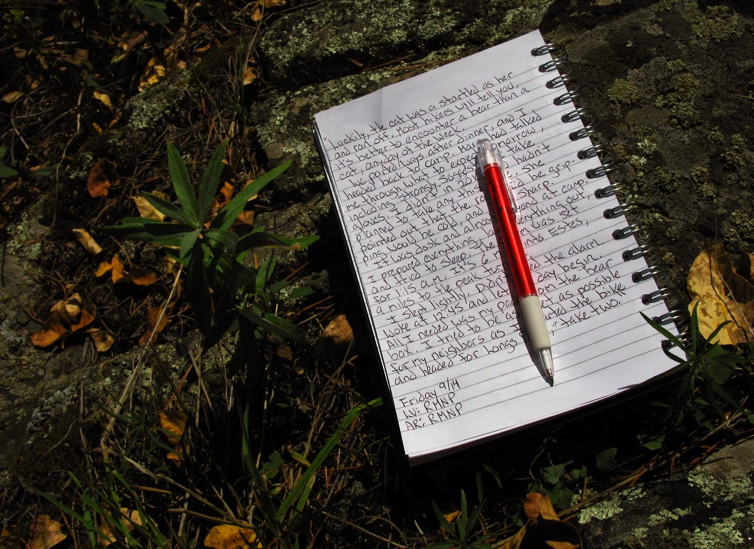
Part of my journal from September 13th.

On the way up. Using light from my headlamp to make the photo.

The first hints of the sun.

Not quite sunrise at The Boulderfield, looking toward The Keyhole at right.

You’ve been warned.

Sun hitting The Boulderfield and Keyhole. Can you spot the shelter hut?

Guess who?

View from inside the shelter.

The Ledges. Note the “bullseyes” to mark the route.

Pretty sure this is looking down from the top of The Trough.

The summit of Longs Peak. I made it!

Summit and altitude marker mounted in the granite.

Standing on the summit of Longs Peak. September 14th, 2012.

One of the Brits. Resting on The Ledges on the descent. It’s a long ways down on the left.

Looking down into The Boulderfield from near The Keyhole on the descent.

Brought home the decal. Maggie, at The Frameworks in Galesburg, did her magic and made it art.